This year we only passed through Montana on the Great Train Adventure and never set foot on the ground. Basically the train followed US Route 2 duplicating our 2008 crossing on the roads.
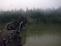
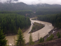
I took this photograph specifically to capture our arrival in Montana and at this point we are heading south along the Kootanai River and only about 50 feet inside the border according to Google. I was not sure if the bridge damage was flooding or deterioriation but by the satelite image it is still broke in 2019 and there is no other bridge for at least 50 miles in either direction.
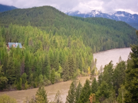
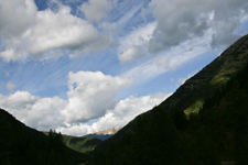
Continuing along US2 just north of Kalispell, Montana we follow the Flathead River filled with meltwater from Glacier National Park in the background.
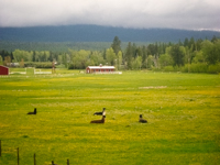
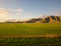
Did I mention something about snow? And a few operating farms but also a lot that have been abandon. By the 2010 census Montana had a total population of less than a million up almost 10% from 2000 mostly due to the oil and gas drilling boom.
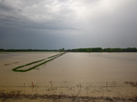
On our last visit Montana had been suffering from over a decade of drought. Well it broke and broke big time which was a large part of our problem visiting the Mississipps-Ohio confluence in Illinois. Farms we had seen dusty dry and cracked were now lakes. It was also causing huge problems for the railroad as the ground absorbed water to swell and heave the tracks out of alignment. Where the train normally traveled at 70mph it was doing 25-30mph and I was not totally comfortable with the sway of the cars.
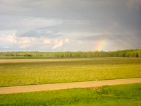
And the rain was continuing with the nice rainbow in the background. I did not realize at the time that the tracks across Montana and North Dakota had been closed most of April, we got through the end of May, and then they would be closed most of June severely disrupting a lot of schedules.
On the way out to see the grandkids in the Seattle, Washington area we only ducked into the southwest corner of Montana to stay overnight in Missoula on our trip through Idaho so I did not get pictures in that area. Returning east we were following US-2 across the northern part of the state meandering but maybe not going quite as slow as we should.

After reading the warnings in the visitor center that vehicles with trailers could not take the road through Glacier National Park we thought to find a place to stay and drop the trailer for a day. The Best Western had a cancellation and could let us have a room for only $195 a night which was rather outside the budget. Checking a $25 per night fleabag she only wanted $95 so we kept moving. For this area we really need a Class C or a trailer since I don't like to camp in a flimsy tent with bears thank you very much.
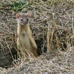
We made an overnight stop in Kalaspel and then stayed for a couple days at a very nice city campground in Selby. I think this was our first experience with local city or county campgrounds and we were pleasantly surprised at the facilities. One of the issues we were facing is that none of the state parks along our route had campgrounds with showers and the electric connection I need for my C-pap breathing machine. While we were enjoying the evening the little ferret was circling the campground checking all the burrows for his dinner.
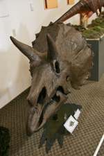

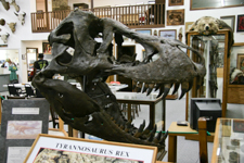
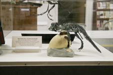
Montana is an extremely rich fossil area and most of the land and therefore the fossils are private property. The state, museums, and universities have a very aggressive program to help the private landowners collect and properly preserve the fossils they find on their land. A typical example is the Rudyard Historical Museum with these very nice displays of fossils found in the local area or on loan from their partner the Museum of the Rockies located in Boseman. In addition to the displays they had a working area and classes on fossil collection, cleaning, and preservation. While I'm not showing it they also had a very nice historical museum with all the typical local artifacts.
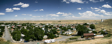
At an overnight stop in Malta the owner explained basic motel economics to us. With the price of gas vacation travel had evaporated and their only choice was to soak the business traveler during the short summer season. Lori is an awesome negotiator and can generally get us seniors on a limited income a halfway decent rate.
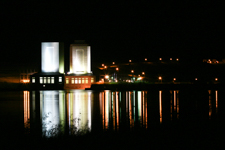
we stayed for a week at the Fort Peck Dam Corp of Engineers campground with showers, flush toilets, electric, and conveniences of modern civilization. Since the Perseids meteor shower was reaching its peak we took a rather chilly evening to observe but did not see very many. The view of the dam lit up at night was a much better view. It was also nice that some of the 911 panic was easing off and they again offered tours on the interior workings at the hydroelectric plant. Fascinating for engineer types.


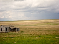
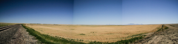
Very few people realize the size of Montana but the major road network is basically on a fifty mile grid and gas was running about four dollars a gallon so we were trying to be selective in our explorations. We considered going to a pioneer village attraction but with a 200 mile drive plus admission decided it was not really worth seventy dollars when we have seen these things before. Driving around the local Fort Peck area offered views of the Missouri River and the dry grasslands. At this point Montana was in a twelve year drought and any fields without irrigation were dead and brown. They had pictures at the spillway showing water flowing over it but I guestimated the current water level was a good seventy feet down. I'll get back to this issue in our 2011 Amtrak trip.
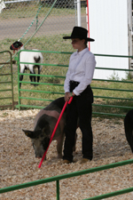
Due to the huge size of the state they were having a Northeast
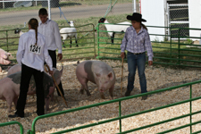
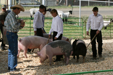
Montana State Fair in nearby Glasgow so we just had to see the swine show. The judge was absolutely wonderful explaining to both the audience and the competitors the requirements and judging criteria. Sadly after all the work these youngsters did in raising their animals many seemed to be wearing one of dad's white shirts with the sleeves rolled up. He also had to explain that while the one young lady had the best animal, showed it very well, and knew the answers to his questions, she lost the blue ribbon because her shirt was not tucked in and she looked sloppy. As my old Sargent told me Even if you don't know what you're doing, look professional.
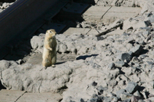
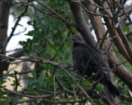
Looking closely you may be able to see this guy in the bottom left corner of the larger image. We stopped here to read the historical marker and capture a photograph of this special place. The Sweet Grass Hills possess special significance to the Blackfeet Indians and to other tribes in the northern Great Plains. According to legend, the Creator Napi fashioned the hills in the dim past out of rocks left over from the formation of the Rocky Mountains. Napi liked his creation so much that the hills became a favored resting place for the old trickster. Located in the heart of a fertile bison hunting ground, the hills served as a vantage point for game and as a lookout for enemies trespassing in Blackfeet territory. Because of their isolation and connection with the creation of the earth, they have deep cultural significance to the Blackfeet as a spiritual refuge where teen-age boys made vision quests to help guide them into adulthood. Many of the Blackfeet's traditional stores take place in and around the hills. One of those involves the Blackfeet culture hero Kutoyis (Blood-Clot-Boy) who sought to rid the world of evil in the early history of the world. It was in the Sweet Grass Hills that Kutoyis defeated Lizard or Frog Man after an epic battle that lasted many days. The Blackfeet paid tribute to his memory by naming the hills
Kutoyisiks
in his honor.