
2010 is our fourth full year of travels. After spending all of December in Louisiana to see my dad we were ready to get on the road again. This year we again headed east but further north than last year basically along I-20 to Atlanta. Then it was through Columbus Ohio to see doctors and friends before getting back to finalize dad's taxes. We were starting to accumulate stuff
so that our trailer with a 3500 pound axle was close to becoming overloaded. We found a guy to install a 4200 pound axle in Lubbock requiring a trip for him to see it and later a visit to install the new axle. After a lengthy mid year visit to Columbus Ohio we headed for the Alleghenies looping from Pennsylvania to Kentucky before stopping again in Columbus Ohio on our way back to December in Louisiana with dad. Due to some shorter stays chasing fall colors we were back up to 44 days of travel and considerable time in Columbus.
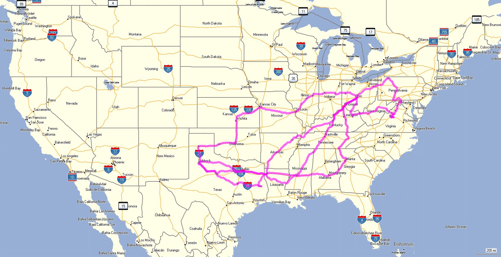
Again for the curious this totals up to only 2,276 miles between motels and campgrounds with local travel over double. It also passes through at least part of 18 states still focused on that Shreveport, Louisiana and Columbus, Ohio axis with the big loop to the east this year. The picture taking nearly doubled with over 5200 photographs to wade through and I added 963 to the site so you can see the states, cities, and special attractions we enjoyed.
This link to the 2010 Travel Map will take you to an extremely detailed view in Google Maps that is fully interactive and can be zoomed in to see the exact routes if you'll be patient while it loads. Google has also started charging for links to their maps so you may see some funny notations until I get that setup