On our Great Train Adventure we crossed Washington and Idaho in the dark and spent the whole day creaping across Montana so the overnight in Williston was appreciated.
I was also very very glad I had made a motel reservation way back in December because the oil and gas drilling was just getting into full swing and EVERY room was packed. I have also been mentioning that we have crossed entire states without ever setting foot on the ground. Here in Williston a guy understood the very late train would be making its normal length stop, grabbed his ATM card, and headed for the bank only to return with the train, all his clothes , medications, and id headed for Chicago, Illinois. Late evening, dressed in shorts, it was decidedly cool and he was in trouble. Thankfully a local church was able to provide him a place to bed down and clothing to make it back to the train.
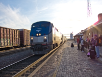
And here is our train the next day arriving almost three hours late.
And I did mention flooding slowing the Montana Crossing? The drought was even more severe in North Dakota and broke with a vengeance. Farm houses we had seen on our prior trip were now sitting in a lake and the ground swelling was distorting the tracks so severely the ride became somewhat scary even at 25mph. Needless to say we were not going to make our connection in Chicago to get back to St Louis, Missouri on schedule and I lost the chances to photograph more of North Dakota. Also for the route courous the train did the same as us in 2008 and turned south at Grand Forks to cross into Minnasota at Fargo, North Dakota.
After our week at Fort Peck, Montana it was just a short trip to Williston and Lewis and Clark SP for another week of camping at a park with real facilities.
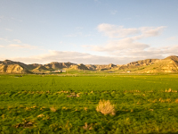
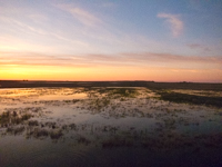
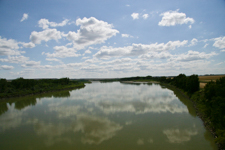
I mentioned a long term drought in the Montana page which they said had lasted over ten years in this area. From the campground Lake Sakajawea is so low it has islands in what should be solid water. Campsites were easily available even in August because the bottom of the marina was a good 25 feet above the current water level and a four inch tree was growing in the middle. No boating, no swimming, no customers.
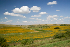
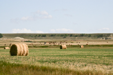
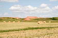
Here is what I consider typical North Dakota. Hills, hay, cows, and somewhat surprising to me huge fields of sunflowers although I remember reading that they are a good cash crop. When Lewis and Clark came through here they described tall grass prairie with vast herds of bison, deer, elk, moose, and antelope with bears, wolves, and other predators. In the late 1800s the railroad opened the Dakotas to huge farms until lower rainfall reduced yields. Since the glaciers started retreating 15-20 thousand or so years ago it has been getting warmer and drier and the current drought is just more of the same,
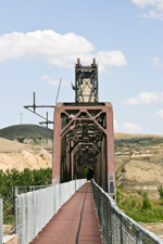
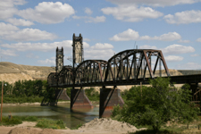
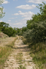
The old railroad crossing for the Yellowstone River is called the Fairview Lift Bridge after the thriving micropolis of Fairview just inside the nearby Montana border. Apparently at one time someone had delusions of steamboats navigating the Yellowstone but the lift was used only once to qualify the bridge. It was also built to allow automobile traffic if you can imagine using a one lane bridge and a tunnel with a curve so there is no clear line of sight. Now closed to autos and rail it is an interesting artifact on a short trail from noplace to noplace.
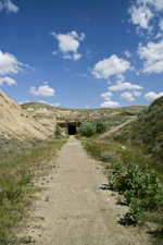
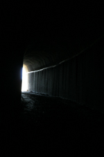
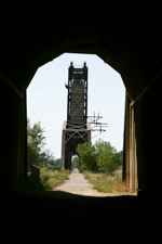
On the North Dakota side the trail leads to the Cartwright Tunnel named for the nearby town of Cartwright which is not even a bump on the road anymore. This is the only completed rail tunnel in the state and with the slight curve the middle is completely dark before opening to a short trail to County Road 1.
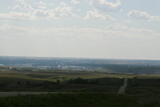
Moving east is an overview of Williston which is the only real town in the area and also over 20 miles from the campground which was hardly convient.
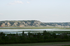
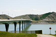
At almost 180 miles long Lake Sakajawea is the third largest man made lake in the country. It also has only two bridges that cross, one near the dam and the Four Bears Bridge about a third of the way from the upper end that we used to make a loop. The history walk at this end of the bridge presents details about the local Native American culture and I have included photographs of the display boards on this other page since the higher resolution pictures may take a little longer to load and bury you in details.
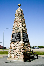
Leaving Williston we spent the night in Minot and then had lunch in Rugby marked here as the geographic center of North America. Not quite sure how they determine that but is probably cost more than the monument. We also met a fellow here who left Seattle like us and was following US-2 like us. The big difference was he was riding a bicycle with one of those baby carriers attached for all his gear.
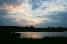
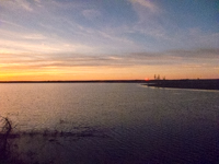
Our next stop was Turtle River SP with a nice sunset but it was again 20 to 25 miles from any of the attractions we wanted to see in Grand Forks. This was starting to become a pattern that while camping was economical the long drives were not. It was also coming up on Labor Day and the whole campground was reserved for the last big drunk of the season.
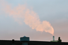
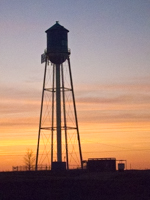
The simple solution was a motel in Grand Forks with an industrial park close by giving a sunset backdrop. I also needed to have the trailer brakes examined because they were not working right. Apparently one of the retreads I ran over cut the wire leading over to the right side brake.
One of the meds I was getting from Walmart was getting low when we discovered another oddity of North Dakota that department stores like Walmart and Target were not allowed to have pharmacies requiring a trip deep into Minnasota. I was also looking at future stops along US-2 and our next major stay at Jay Cooke SP near Duluth, Minnesota was forecast for freezing temperatures. Based on our experience at Emigrant Springs SP in Oregon we decided it was time for a huge right turn and headed south to Fargo. I have put our visits the Red River Zoo and Bonanzaville on these separate pages both because of their size and I would like to come back to make additions. Also the Hjemkomst Center just across the river in Minnesota was another wonderful place we visited in the Fargo area.